Archive for the ‘ Vietnam ’ Category

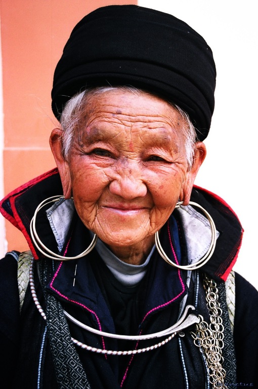
Hmong People

Hmong People

Hmong People – Vietnam – 2006

The terms Hmong (pronounced [m̥ɔ̃ŋ]) and Mong ([mɔ̃ŋ]) refer to an Asian ethnic group in the mountainous regions of southeast Asia. Hmong are also one of the largest sub-groups in the Miao minzu population in southern China. Beginning in the 18th century, Hmong groups began a gradual southward migration due to political unrest and to find more arable land. As a result, Hmong currently also live in several countries in Southeast Asia, including northern VietnamLaosThailand, and Myanmar-Burma.

In Laos, a significant number of Hmong/Mong people fought against the communist-nationalist Pathet Lao during the Secret War. When the Pathet Lao took over the government in 1975, Hmong/Mong people were singled out for retribution, and tens of thousands fled to Thailand for political asylum. Since the late 1970s, thousands of these refugees have resettled in Western countries, mostly the United States, but alsoAustraliaFranceFrench Guiana, and Canada. Others have been returned to Laos under United Nations-sponsored repatriation programs. Around 8,000 Hmong/Mong refugees remain in Thailand.[3]


Hmong people have their own terms for their subcultural divisions, “White Hmong” (Hmong Der) and “Green” or “Blue Mong” (Mong Leng) being the terms for two of the largest groups. In the Romanized Popular Alphabet, developed in the 1950s in Laos, these terms are writtenHmoob Dawb (White Hmong) and Moob Leeg (Green Mong). The doubled vowels indicate nasalization, and the final consonants indicate with which of the eight lexical tones the word is pronounced. White Hmong and Green Mong people speak mutually intelligible dialects of the Hmong language with some differences in pronunciation and vocabulary. One of the most obvious differences is the use of the aspirated /m/ in White Hmong (indicated by the letter “h”) not found in the Green Mong dialect. Other groups of Hmong/Mong people include the Black Hmong (Hmoob Dub), Striped Hmong (Hmoob Txaij/Hmoob Quas Npab), Hmong Shi, Hmong Pe, Hmong Pua, and Hmong Xau.[4]

Since 1949, Miao has been an official term for one of the 55 official minority groups recognized by the government of the People’s Republic of China. The Miao live mainly in southern China, in the provinces of GuizhouHunanYunnanSichuanGuangxiHainanGuangdongHubei, and elsewhere in China. According to the 2000 census, the number of ‘Miao’ in China was estimated to be about 9.6 million. The Miao nationality includes Hmong/Mong people as well as other culturally- and linguistically-related ethnic groups who do not call themselves either Hmong or Mong. These include the Hmu, Kho (Qho) Xiong, and A Hmao. The White Miao (Bai Miao) and Green Miao (Qing Miao) are both Hmong/Mong groups.

A Han boy (in blue) with three little Hmong girls.

Usage of the term “Miao” in Chinese documents dates back to the Shi Ji (1st century BC) and the Zhan Guo Ce (late Western Han Dynasty). During this time, it was generally applied to people of the southern regions thought to be descendants of the San Miao kingdom (dated to around the 3rd century BC.) The term does not appear again until the Ming dynasty (1368–1644), by which time it had taken on the connotation of “barbarian.” Interchangeable with “man” and “yi,” it was used to refer to the indigenous people of the south-western frontier who refused to submit to imperial rule. During this time, references to Raw (Sheng) and Cooked (Shu) Miao appear, referring to level of assimilation and political cooperation of the two groups. Not until the Qing dynasty (1644–1911) do more finely grained distinctions appear in writing. Even then, discerning which ethnic groups are included in various classifications can be problematic.[5] This inconsistent usage of “Miao” makes it difficult to say for sure if Hmong/Mong people are always included in these historical writings. Linguistic evidence, however, places Hmong/Mong people in the same regions of southern China that they inhabit today for at least the past 2,000 years.[6] By the mid-18th century, classifications become specific enough that it is easier to identify references to Hmong/Mong people.

In Southeast Asia, Hmong/Mong people are referred to by other names, including: Vietnamese: Mèo or H’Mông; Thai: แม้ว (Maew) or ม้ง (Mong);Burmesemun lu-myo. “Mèo“, or variants thereof, is considered highly derogatory by many Hmong/Mong people and is infrequently used today outside of Southeast Asia.[7]

Because the Hmong lived mainly in the highland areas of Southeast Asia and China, the French occupiers of Southeast Asia gave them the name Montagnards or “mountain people”, but this should not be confused with the Degar people of Vietnam, who were also referred to as Montagnards.

Sa Pa

Sa Pa

Sa Pa – Vietnam – 2006

Sa Pa Sa Pa.ogg pronunciation (help·info) or Sapa (Westernized spelling) is a frontier town and district in the Lào Cai province in northwestVietnam. It is one of the main market towns in the area, where many ethnic minority groups such as H’mong, Dao and Tay live.

It is most likely that Sa Pa was first inhabited by highland minorities of the Hmong and Yao groups, as well as by smaller numbers of Tày and Giay, these being the four main minority groups still present in Sa Pa district today. The Kinh (lowland Vietnamese) never originally colonised this highest of Việt Nam’s valleys, which lies in the shadow of Phan-Xi-Pǎng (Fansipan, 3143 meters), the highest peak in the country.

It was only when the French debarked in highland Tonkin in the late 1880s that Sa Pa, or Chapa as the French called it, began to appear on the national map. In the following decade, the future site of Sa Pa town started to see military parties as well as missionaries from the Société des Missions Etrangères de Paris (MEP) visit. The French military marched from the Red River Delta into the northern mountainous regions as part of Tonkin’s ‘pacification’. In 1894-96 the border between China and Tonkin was formally agreed upon and the Sa Pa area, just to the south of this frontier, was placed under French authority. From 1891 the entire Lào Cai region, including Sa Pa, came under direct colonial military administration so as to curtail banditry and political resistance on the sensitive northern frontier.

The first permanent French civilian resident arrived in Sa Pa in 1909. With its attractive continental climate, health authorities believed the site had potential. By 1912 a military sanatorium for ailing officers had been erected along with a fully fledged military garrison. Then, from the 1920s onwards, several wealthy professionals with enough financial capital also had a number of private villas built in the vicinity.

At the end of the Second World War a long period of hostilities began in Tonkin that was to last until 1954. In the process, nearly all of the 200 or so colonial buildings in or around Sa Pa were destroyed, either by Việt Minh sympathisers in the late 1940s, or, in the early 1950s by French air raids. The vast majority of the Viet population fled for their lives, and the former town entered a prolonged sleep.

Sa Pa church

In the early 1960s, thanks to the New Economic Zones migration scheme set up by the new Socialist regime, new inhabitants from the lowlands started to migrate to the region.

The short 1979 occupation of the northern border region by Chinese troops had little impact on Sa Pa town, but did force the Kinh (lowland Vietnamese) population out for a month.

In 1993 the last obstacle to Sa Pa’s full rebirth as a prominent holiday destination was lifted as the decision was made to open the door fully to international tourism. Sa Pa was back on the tourist trail again, this time for a newly emerging local elite tourist crowd, as well as international tourists.

In 2006, the Chairman of The People’s Committee of Sapa Province was elected to The Communist Party Central Committee as the youngest ever member (born in 1973).

Sa Pa District is located in Lao Cai Province, north-west Vietnam, and 350 km north-west of Hanoi, close to the border with China. The Hoang Lien Son range of mountains dominates the district, which is at the eastern extremity of the Himalayas. This range includes Vietnam’s highest mountain, Fan Si Pan, at a height of 3142m above sea level. The town of Sa Pa lies at an altitude of about 1600 m. The climate is moderate and rainy in summer (May—August), and foggy and cold with occasional snowfalls in winter.

View on the mountains from downtown Sapa

Sa Pa is a quiet mountain town and home to a great diversity of ethnic minority peoples. The total population of 36,000 consists mostly of minority groups. Besides the Kinh (Viet) people (15%) there are mainly 5 ethnic groups in Sapa: Hmong 52%, Dao 25%, Tay 5%, Giay 2% and a small number of Xa Pho. Approximately 7,000 live in Sapa, the other 36,000 being scattered in small communes throughout the district.

Terraced fields in Sa Pa

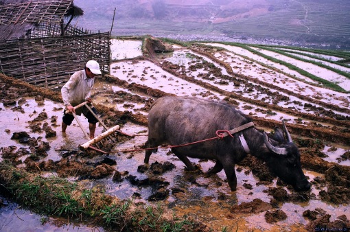
Most of the ethnic minority people work their land on sloping terraces since the vast majority of the land is mountainous. Their staple foods are rice and corn. Rice, by its very nature of being a labour intensive crop, makes the daily fight for survival paramount. The unique climate in Sapa has a major influence on the ethnic minorities who live in the area. With sub-tropical summers, temperate winters and 160 days of mist annually, the influence on agricultural yields and health related issues are significant.

The minority people can only yield one crop of rice annually, which leads to food shortfalls in many communes at specific times. This shortage of food contributes to malnutrition and other related health problems. The climatic conditions also contribute to many health issues including coughs, colds, and bronchial and respiratory problems that are commonplace throughout the community.

The geographical location of the area makes it a truly unique place for many interesting plants and animals, allowing it to support many inhabitants. Many very rare or even endemic species have been recorded in the region.

The scenery of the Sa Pa region in large part reflects the relationship between the minority people and nature. This is seen especially in the paddy fields carpeting the rolling lower slopes of the Hoang Lien Mountains. The impressive physical landscape which underlies this has resulted from the work of the elements over thousands of years, wearing away the underlying rock. On a clear day, the imposing peak of Fan Si Pan comes into view. The last major peak in the Himalayan chain, Fan Si Pan offers a real challenge to even the keenest walker, the opportunity of staggering views, and a rare glimpse of some of the last remaining primary rain forest in Vietnam.

Geology, climate and human activity have combined to produce a range of very distinct habitats around Sa Pa. Especially important is Sa Pa’s geographic position, at the convergence of the worlds 14 “biomes” (distinct biographic areas), producing an assemblage of plant and animal species unique in the world.


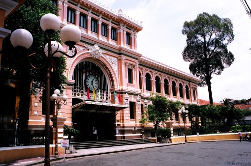
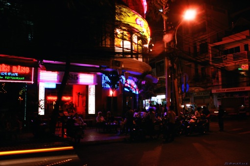
Ho Chi Minh City

Ho Chi Minh City

Ho Chi Minh City – Vietnam – 2006

Ho Chi Minh City (Vietnamese: Thành phố Hồ Chí Minh Thanh Pho Ho Chi Minh.ogg pronunciation (help·info) ) is the largest city in Vietnam. Under the name Prey Nokor (Khmer) it was the main port of Cambodia, before being annexed by the Vietnamese in the 17th century. Under the nameSaigon (Vietnamese: Sài Gòn; Saigon.ogg pronunciation (help·info)), it was the capital of the French colony of Cochinchina and later of the independent state of South Vietnam from 1954 to 1975. In 1976, Saigon merged with the surrounding province of Gia Định and was officially renamed Hồ Chí Minh City (although the name Sài Gòn – formally known as District 1 – is still commonly used.[1])

The city center is situated on the banks of the Saigon River, 60 kilometers (37 mi) from the South China Sea [2] and 1,760 kilometers (1,094 mi) south of Hanoi, the capital of Vietnam.

The metropolitan area, which consists of Hồ Chí Minh City metro area, Thủ Dầu MộtDi AnBien Hoa and surrounding towns, is populated by more than 9 million people,[3] making it the most populous metropolitan area in Vietnam and Indochina. The Greater Ho Chi Minh City Metropolitan Area, a metropolitan area covering most part of Dong Nam Bo plus Tien Giang and Long An provinces under planning will have an area of 30,000 square kilometers with a population of 20 million inhabitants by 2020.[4]

Traditional Vietnamese name

After Prey Nokor was settled by Vietnamese refugees from the north, in time it came to be known unofficially as Sài Gòn. There is much debate about the origins of the Vietnamese name, Sài Gòn, the etymology of which is analyzed below.

It should be noted, however, that before the French colonization, the official Vietnamese name of Saigon was Gia Định (Chữ Nôm). In 1862, the French discarded this official name and adopted the name “Saigon”, which had always been the popular name, although it was still written as  on sinitic maps until at least 1891.[5]

From an orthographic point of view, the Vietnamese name, Sài Gòn, is written in two words, which is the traditional convention in Vietnamese spelling. Some people, however, write the name of the city as SaiGon or Saigon in order to save space or give it a more Westernized look.

[edit]Sino-Vietnamese etymology

A frequently heard, and reasonable, explanation is that Sài is a Chinese loan word (Chinese, pronounced chái in Mandarin) meaning “firewood, lops, twigs; palisade”, while Gòn is another Chinese loan word (Chinese: , pronounced gùn in Mandarin) meaning “stick, pole, bole”, and whose meaning evolved into “cotton” in Vietnamese (bông gòn, literally “cotton stick”, i.e. “cotton plant”, then shortened to gòn).[6]

Some people say that this name originated from the many cotton plants that the Khmer people had planted around Prey Nokor, and which can still be seen at Cây Mai temple and surrounding areas.[6]

Another explanation is that the etymological meaning “twigs” (sài) and “boles” (gòn) refers to the dense and tall forest that once existed around the city, a forest to which the Khmer name, Prey Nokor, already referred.

In Chinese, the city is referred to as 西, pronounced “sai gung” in Cantonese and Xīgòng in Mandarin. This represents “Saigon” written phonetically.

[edit]Khmer etymology

Another etymology often proposed, although held now as a least likely etymology, is that “Saigon” comes from “Sai Con”, which would be the transliteration of the Khmer word, prey kor (), meaning “god or heavenly”. Nokor is a Khmer word of Sanskrit origin meaning “city, land”).

This Khmer etymology theory is quite interesting given the Khmer context that existed when the first Vietnamese settlers arrived in the region. However, it fails to completely explain how Khmer “prey” led to Vietnamese “Sài”, since these two syllables appear phonetically quite distinct and as the least reasonable and least likely candidate from the khmer etymology.

[edit]Cantonese etymology

Another reasonable etymology was offered by Vương Hồng Sển, a Vietnamese scholar in the early 20th century, who asserted that Sài Gòn had its origins in the Cantonese name ofCholon (Vietnamese: quoc ngu Chợ Lớnchu nom ) , the Chinese district of Saigon. The Cantonese (and original) name of Cholon is “Tai-Ngon” (), which means “embankment” (French: quais). The theory posits that “Sài Gòn” derives from “Tai-Ngon”.

[edit]Current Vietnamese name

Immediately after the communist takeover of South Vietnam in 1975, a provisional government renamed the city after Ho Chi Minh, a former North Vietnamese leader. The official name is now Thành phố Hồ Chí Minh, abbreviated Tp. HCM. In English this is translated as Ho Chi Minh City, abbreviated HCMC, and in French it is translated as Hô Chi Minh Ville (thecircumflex is sometimes omitted), abbreviated HCMV. Sài Gòn is still the most common way to refer to the city in conversation. Sài Gòn is used officially to refer to District 1, for example in bus destinations. The name is also found in company names, book titles and even on airport departure boards (the code for Tan Son Nhat International Airport is SGN).

Ho Chi Minh City is located at 10°45’N, 106°40’E in the southeastern region of Vietnam, 1,760 km (1,094 miles) south of Hanoi. The average elevation is 19 meters (63 ft) above sea level. It borders Tay Ninh and Binh Duong provinces to the north, Dong Nai and Ba Ria-Vung Tau provinces to the east, Long An Province to the west and the South China Sea to the south with a coast of 15 km in length. The city covers an area of 2,095 km² (809 sq mi) (0.63% of the surface of Vietnam), extending up to Cu Chi (12mi/20 km from the Cambodian border), and down to Can Gio on the East Sea coast. The distance from the northernmost point (Phu My Hung Commune, Cu Chi District) to the southernmost one (Long Hoa Commune, Can Gio District) is 102 kilometers (63 mi), and from the easternmost point (Long Binh Ward, District Nine) to the westernmost one (Binh Chanh Commune, Binh Chanh District) is 47 kilometers (29 mi).

The city has a tropical climate, with an average humidity of 75%. A year is divided into two distinct seasons. The rainy season, with an average rainfall of about 1,800 millimetres (71 in) annually (about 150 rainy days per year), usually begins in May and ends in late November. The dry season lasts from December to April. The average temperature is 28 °C (82 °F), the highest temperature sometimes reaches 39 °C (102 °F) around noon in late April, while the lowest may fall below 16 °C (61 °F) in the early mornings of late December.

Hanoi

Hanoi

Hanoi – Vietnam – 2006

Hanoi (Vietnamese: Hà Nội, Hán TựHa_noi.ogg pronunciation (help·info), estimated population 3,398,889 (2007) [1], is the capital ofVietnam. From 1010 until 1802, with a few brief interruptions, it was the political centre of an independent Vietnam. It was eclipsed byHuế during the Nguyen Dynasty as the capital of Vietnam, but Hanoi served as the capital of French Indochina from 1887 to 1954. From 1954 to 1976, it was the capital of North Vietnam.

The city is located on the right bank of the Red River. Hanoi is located at 21°2′N 105°51′ECoordinates21°2′N 105°51′E, 1760 km (1094 mi) north of Ho Chi Minh City, formerly called Saigon.

On May 29 2008, it was decided that Ha Tay province, Vinh Phuc‘s Me Linh district and 3 communes of Luong Son district, Hoa Binh is merged into the metropolitan area of Hanoi from August 1 2008[2]. Hanoi’s total area increased to 334,470 hectares divided into 29 subdivisions[3]. The new population is 6,232,940[3]. October 2010 will officially mark 1000 years of the establishment of the city.

Hanoi has been inhabited since at least 3000 BC. One of the first known permanent settlements is the Co Loa citadel founded around 200 BC.

Hanoi has had many names throughout history, all of them of Sino-Vietnamese origin. During the Chinese domination of Vietnam, it was known as Tống Bình () and later Long Đỗ (; literally “dragon’s belly”). In 866, it was turned into a citadel and was named Đại La ().

In 1010, Lý Thái Tổ, the first ruler of the Lý Dynasty, moved the capital of Đại Việt (大越, the Great Viet, then the name of Vietnam) to the site of the Đại La Citadel. Claiming to have seen a dragon ascending the Red River, he renamed it Thăng Long (昇龍Ascending dragon) – a name still used poetically to this day. It remained the capital of Vietnam until 1397, when the capital was moved to Thanh Hóa, also known as Tây Đô (西Western Capital). Thăng Long then became Đông Đô (Eastern Capital).

In 1408, Vietnam was invaded by Chinese troops from the Ming Dynasty and Đông Đô was renamed Đông Quan (Eastern Gateway) by the Chinese. In 1428, Vietnam was liberated from Chinese rule by Lê Lợi, the founder of the Le Dynasty and Đông Quan was renamed Đông Kinh (Eastern Capital – the name known to Europeans as Tonkin. The same characters are used for Tokyo,Japan). During the Tây Sơn Dynasty, it was named Bắc Thành (Northern Citadel).

Hoàn Kiếm Lake in the centre of Hanoi, with the streets of the old town in the background (1999)
Tháp Bút (pen tower) next to Hoàn Kiếm Lake (2007)

In 1802, when the Nguyễn Dynasty was established and then moved the capital down to present-day Huế, it was renamed Thăng Long ( “ascending dragon”). However, the second syllable of the toponym is actually a homonym of the word long, and so, actually suggests “to flourish” as opposed to “dragon”. Therefore, the name would then have appeared as , roughly to ascend and flourish. In 1831 the Nguyen Dynasty renamed it Hà Nội (, can be translated as Between Rivers or River Interior) . Hanoi was occupied by the French in 1873 and passed to them ten years later. It became the capital of French Indochina after 1887.

The city was occupied by the Japanese in 1940, and liberated in 1945, when it briefly became the seat of the Viet Minh government after Hồ Chí Minh proclaimed the independence of Việt Nam. But the French came back and reoccupied the city in 1946. After nine years of fighting between the French and Viet Minh forces, Hanoi became the capital of an independent North Vietnam in 1954.

During the Vietnam War Hanoi’s transportation facilities were disrupted by the bombing of bridges and railways, which were, however, promptly repaired. Following the end of the war, Hanoi became the capital of Vietnam when North and South Vietnam were reunited on July 21976.

On August 1, 2008, Hanoi absorbed the neighboring province of Ha TayVinh Phuc‘sMe Linh district, and three communes from Luong SonHoa Binh, effectively tripling its size.

Hanoi experiences the typical climate of northern Vietnam, where summers are hot and humid, and winters are relatively cool and dry. The summer months from May to September receive the majority of rainfall in the year (1,682 mm rainfall/ year). The winter months from November to March are relatively dry, although spring then often brings light rains. The minimum winter temperature in Hanoi can dip as low as 6–7°C (43°F) not including the wind chill, while summer can get as hot as 38–40°C (100-104°F).[4]

Hội An

Hoi An

Hội An – Vietnam – 2006

Hội An Hoi An.ogg pronunciation (help·info) is a small city on the coast of the South China Sea in the South Central Coast of Vietnam. It is located in the Quảng Nam province and is home to approximately 88,000 inhabitants.

The city possessed the largest harbour in Southeast Asia in the 1st Century and was known as Lâm Ấp Phố (Champa City).

Triều Châu Assembly Hall

The former harbour town of the Champa people at the estuary of the Thu Bon river was an important Vietnamese trading centre in the 16th and 17th centuries, where Chinese from various provinces as well as JapaneseDutch and Indians settled. During this period of the China trade, the town was called Hai Pho (Seaside Town) in Vietnamese. Originally Hai Pho was a divided town with the Japanese settlement across the “Japanese Bridge”(16th-17th century). The bridge (Chùa cầu) is a unique covered structure built by the Japanese, the only known covered bridge with a Buddhist pagoda attached to one side.

The town is known to the French and Spanish as Faifo, and by similar names inPortuguese and Dutch. A number of theories have been put forth as to the origin of this name. Some scholars have suggested that it comes from the word “hải-phố” () meaning “sea town”, while others have said that it is more likely simply a shortening of Hội An-phố (), “the town of Hoi An”, to “Hoi-pho” which became “Faifo”.[1]

In 1999, the old town was declared a World Heritage site by UNESCO as a well-preserved example of a Southeast Asian trading port of the 15th to 19th centuries, with buildings that display a unique blend of local and foreign influences.

Today, Hội An is still a small city, but it attracts a fair number of tourists, also being a well-established place on the backpacker trail. Many visit for the numerous art and craft shops and tailors, who produce made-to-measure clothes for a fraction of the western price.[2] Several Internet cafés, bars and restaurants have opened along the riverfront. Hoi An is famed for its centuries oldCao lầu noodle, which can only be uniquely served here.


Hoi An was founded as a trading port by the Nguyen Lord Nguyen Hoang sometime around 1595. The Nguyễn Lords were far more interested in commercial activity than the Trịnh Lords who ruled the north. As a result, Hoi An flourished as a trading port and became one of the most important trade ports on the South China Sea. Captain William Adams, the famous English sailor and confidant of Tokugawa Ieyasu, is known to have made at least one trading mission to Hoi An (around 1619).

In the 1700s Hoi An was considered by some Chinese merchants to be the best destination for trading in all of South East Asia.[3]However the importance of Hoi An declined sharply at the end of the 1700s due to the collapse of the Nguyen rule (thanks to theTay Son Rebellion – which was opposed to foreign trade). Then, with the triumph of Emperor Gia Long, he repaid the French for their aid by giving them exclusive trade rights to the nearby port town of Da Nang. Da Nang became the new center of trade (and later French influence) in central Vietnam while Hoi An was a forgotten backwater. Local historians also say that Hoi An lost its status as a desirable trade port due to silting up of the river mouth.

The result was the Hoi An remained almost untouched by the changes to Vietnam over the next 200 years (somewhat reminiscent to the famous walled city of Carcassonne in southern France).