Vancouver Island


Vancouver Island – Canada – 2006
Vancouver Island is a large island in British Columbia, Canada, one of several North American regions named after George Vancouver, the British Royal Navy officer who explored the Pacific coast of North America between 1791 and 1794.
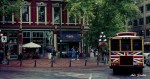
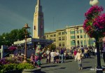
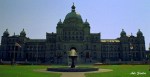
The island is 460 kilometres (285 mi) in length and 80 kilometres (50 mi) in width at its widest point. It is the largest island on the western side of North America at 32,134 km² (12,407 sq mi) and the world’s 43rd largest island, Canada’s 11th largest island and Canada’s second most populous island after the Island of Montreal, which has 1.3 million more people. The 2001 census population was 656,312. British Columbia statistics in 2004 estimated the population at 734,860.[1] Slightly fewer than half of these (331,491) live in Greater Victoria. Other major cities on Vancouver Island include Nanaimo, Port Alberni, Parksville, Courtenay, and Campbell River.
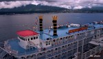
Vancouver Island is located in the southwestern corner of the province of British Columbia. It is separated from mainland Canada by the Strait of Georgia, Johnstone Strait, and Queen Charlotte Strait, and from the United States by the Strait of Juan de Fuca. To the west of the island is the Pacific Ocean.
The Vancouver Island Ranges run most of the length of the island, dividing it into a wet and rugged west coast and a drier, more rolling east coast. The highest point in these ranges and on the island is the Golden Hinde, at 2,195 metres (7,200 ft). Located near the centre of Vancouver Island in the 2,500 km² (620,000 acre) Strathcona Provincial Park, it is part of a group of peaks that include the only glaciers on the island, the largest of which is theComox Glacier. The Golden Hinde is also part of the Karmutsen Formation, which is a sequence of tholeiitic pillow basalts and breccias. The west coast shoreline is rugged and in many places mountainous, characterised by its many fjords, bays, and inlets. The interior of the island has many lakes (Kennedy Lake, northeast of Ucluelet, is the largest) and rivers. Vancouver Island formed when volcanic and sedimentary rock scraped off the ancientKula Plate and plastered against the continental margin when it was subducting under North America 55 million years ago.
The climate is the mildest in Canada, with temperatures on the coast even in January being usually above 0 °C (32 °F). In summer, the warmest days usually achieve a maximum of 28-33 degrees Celsius. However, the rain shadow effect of the island’s mountains, as well as the mountains ofWashington‘s Olympic Peninsula, creates wide variation in precipitation. The west coast is considerably wetter than the east coast. Average annual precipitation ranges from 665 centimetres (260 in) at Henderson Lake on the west coast (making it the wettest place in North America) to only 64 centimetres (25 in) at the driest recording station in the provincial capital of Victoria on the southeast coast’s Saanich Peninsula. Precipitation is heaviest in the autumn and winter. Snow is rare at low altitudes but is common on the island’s mountaintops in winter.
A notable feature of Vancouver Island is the extension of Mediterranean-type summer dryness to latitudes as high as 50°N. Only in the extreme north of the island near Port Hardy is the rainfall of the driest summer month as much as one fifth that of the wettest months from November to March. West coasts of other continents at similar latitudes have a practically even distribution of rainfall through the year.
Vancouver Island lies in the temperate rainforest biome. On the southern and eastern portions of the island, this is characterized by Douglas-fir, western red cedar, arbutus, Garry oak, salal, Oregon-grape, and manzanita; moreover, Vancouver Island is the location where the Douglas-fir was first recorded by Archibald Menzies;[2] Vancouver Island is also the location where the tallest Douglas fir was ever recorded. This southeastern portion of the island is the heavily populated region of Vancouver Island and a major area for recreation. The northern, western, and most of the central portions of the island are home to the coniferous “big trees” associated with British Columbia’s coast — hemlock, western red cedar, amabilis fir, yellow cedar, Douglas-fir,grand fir, Sitka spruce, and western white pine. It is also characterised by broadleaf maple, red alder, sword fern, and red huckleberry.
The fauna of Vancouver Island is similar to that found on the mainland coast, with some notable exceptions and additions. For example, grizzly bears,mountain goats, porcupines, moose, skunks, coyotes, and numerous species of small mammals, while plentiful on the mainland, are absent from Vancouver Island. The island does support most of Canada’s Roosevelt elk, however, and one species — the Vancouver Island Marmot — is unique to the island. The island’s rivers, lakes, and coastal regions are renowned for their fisheries of trout, salmon, and steelhead. It has the most concentrated population of cougars in North America.
In 1946, the Forbidden Plateau in the east of the Vancouver Island Ranges was the epicenter of an earthquake that registered 7.3 on the Richter scale, the strongest ever recorded on land in Canada. See 1946 Vancouver Island earthquake.[3]
Vancouver Island was the location of the observation of the episodic tremor and slip seismic phenomenon.
Indigenous people
Vancouver Island has been the homeland to many main indigenous peoples for thousands of years.[4] These are the Kwakwaka’wakw, Nuu-chah-nulth, and Coast Salish. Kwakwaka’wakw territory includes northern Vancouver Island, with parts of the mainland, then Nuu-chah-nulth spanning from the northern western part of the island, to the south, covering the west coast, and Coast Salish covering the lower eastern part. Their cultures are connected to the natural resources abundant in the area.
[edit]European exploration
Europeans began to explore the island in 1774, when rumours of Russian fur traders caused the Spanish to send a ship, the Santiago north under the command of Juan José Pérez Hernández. In 1775, a second Spanish expedition under the Peruvian captain Juan Francisco de la Bodega y Quadra was sent.
Vancouver Island came to the attention of the wider world after the third voyage of Captain James Cook, who landed at Nootka Sound of the island’s western shore on March 31, 1778, and claimed it for the United Kingdom. The island’s rich fur trading potential led the British East India Company to set up a single-building trading post in the native village of Yuquot (Friendly Cove) on Nootka Island, a small island in the sound.
The island was further explored by Spain in 1789 by Esteban José Martínez, who built Fort San Miguel on one of Vancouver Island’s small offshore islets in the sound near Yuquot. This was to be the only Spanish settlement in what would later be Canada. The Spanish began seizing British ships, and the two nations came close to war in the ensuing Nootka Crisis, but the issues were resolved peacefully with the Nootka Convention in 1792, in which both countries recognized the other’s rights to the area. Supervising the British activities was CaptainGeorge Vancouver from King’s Lynn in England, who had sailed as a midshipman with Cook, and from whom the island gained its name. In 1792, the Spanish explorer Dionisio Alcalá Galiano and his crew were the first Europeans to circumnavigate Vancouver Island. While we know this island today as Vancouver Island the English explorer had not intentionally meant to name such a large body of land solely after himself.[5] In his September 1792 dispatch log report for the British Admiralty, Captain Vancouver reveals that his decision here was rather meant to honour a request by the Peruvian seafarer Juan Francisco Quadra that Vancouver:
- “would name some port or island after us both in commemoration of our meeting and friendly intercourse that on that occasion had taken place (Vancouver had previously feted Quadra on his ship);….and conceiving no place more eligible than the place of our meeting, I have therefore named this land…The Island of Quadra and Vancouver.”[6]
If Vancouver had been vain as some writers had charged, he could have chosen to name the entire Island exclusively after himself instead of sharing its name with Quadra and placing the latter’s name before his. The newly-discovered “Quadra’s and Vancouver’s Island” was the most prominent name on maps of the coast, and appeared on most [contemporary] British, French and Spanish maps of the period. But as Spanish interests in the region dwindled, so did Quadra’s name. The Hudson’s Bay Company played a major part in the transition; by 1824 ‘Vancouver’s Island’ had become the usual designation in its correspondence for the island.[7] A quarter of a century later, Vancouver Island had become such a well known geographical feature, that the founding of the Colony of Vancouver Island in 1849 gave this name full official status.[8] Period references to “Vancouver” referred to Vancouver Island until the naming of the city of Vancouver in 1885.