Statue of Liberty National Monument

Statue of Liberty National Monument

The Statue of Liberty National Monument, Ellis Island and Liberty Island is a single listing on the U.S. National Register of Historic Places located in the Upper New York Bay oppostite the shores of Liberty State Park in Jersey City, New Jersey. It includes the national monument the Statue of Liberty, situated on Liberty Island, and Ellis Island. Owned by the federal government and operated by the National Park Service, the site encompasses properties in the states of New York and New Jersey.

The historic district was mostly constructed during the late 19th and early 20th century, and and speaks to a period of massive immigration to the United States. Public access is permitted only by ferries from either Communipaw Terminal in Liberty State Park or Castle Clinton inBattery Park in Lower Manhattan.

Federal property in New Jersey and New York

Liberty Island and Ellis Island has been the property of the United States government since 1800. Historical circumstances have led to the unusual situation of the built portions of Liberty Island and 3.5 acres of Ellis Island being exclaves of one state, New York, located completely within another, New Jersey. The dominion, jurisdiction, and sovereignity of the islands has variously been the subject of a colonial land grant, a provincial governor’s directive, an interstate compact as well as several court cases and US Supreme Court decisions. Liberty Island and the acreage on Ellis Island are part of New York City and are bounded completely by the municpal borders of Jersey City, New Jersey, which retains riparian rights to all its portions of the Hudson River and the Upper New York Bay. Jurisdiction not superseded by the federal government falls to the appropriate state. Ellis Island is jointly administered by both.

External links

Lake Pukaki

Lake Pukaki – New Zealand / 2009

Lake Pukaki is the largest of three roughly parallel alpine lakes running north-south along the northern edge of the Mackenzie Basin on New Zealand‘s South Island. The others are Lakes Tekapo and Ohau. All three lakes were created when the terminal moraines of receding glaciers blocked their respective valleys, forming moraine-dammed lakes.

The glacial feed to the lakes gives them a distinctive blue colour, created by glacial flour, the extremely finely ground rock particles from the glaciers. Lake Pukaki covers an area of 178.7 km², and the surface elevation of the lake normally ranges from 518.2 to 532 metres above sea level.[2]

The lake is fed at its northern end by the braided Tasman River, which has its source in the Tasman andHooker Glaciers, close to Aoraki/Mount Cook. Good views of the mountain, 70 kilometres to the north, can be had from the southern shore of the lake.

The lake is now part of the Waitaki hydroelectric scheme. The lake’s original outflow was at its southern end, into the Pukaki River. The outflow has been dammed, and canals carry water from Lake Pukaki andLake Ohau through the Ohau A power station to Lake Ruataniwha. Pukaki is also fed by the waters ofLake Tekapo, which are diverted through a canal to a power station on Pukaki’s eastern shore (Tekapo B station). The lake has been raised twice to increase storage capacity (9m in the 1940s, 37m in the 1970s), submerging Five Pound Note Island, which once appeared on New Zealand’s five pound note. The current lake has an operating range of 13.8 m (the level within which it can be artificially raised or lowered), giving it an energy storage capacity of 1,595 GWh). Along with Lake Tekapo’s 770 GWh storage, it provides over half New Zealand’s hydroelectricity storage capacity.

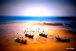
Tilt-Shift Photography

Tilt-Shift Photography

Refers to the use of camera movements on small- and medium-format cameras, and sometimes specifically refers to the use of tilt for selective focus, often for simulating a miniature scene. Sometimes the term is used when the shallow depth of field is simulated with digital postprocessing; the name may derive from the tilt-shift lens normally required when the effect is produced optically.

“Tilt-shift” actually encompasses two different types of movements: rotation of the lens plane relative to the image plane, called tilt, and movement of the lens parallel to the image plane, called shift. Tilt is used to control the orientation of the plane of focus (PoF), and hence the part of an image that appears sharp; it makes use of the Scheimpflug principle. Shift is used to change the line of sight while avoiding the convergence of parallel lines, as when photographing tall buildings.

History and use

Movements have been available on view cameras since the early days of photography. Nikon introduced a lens providing shift movements for their 35 mm SLR cameras in the mid 1960s, and Canon introduced a lens that provided both tilt and shift movements in 1973; many other manufacturers soon followed suit. Canon and Nikon each currently offer several lenses that provide both movements. Such lenses are frequently used in architectural photography to control perspective, and in landscape photography to get an entire scene sharp.

Some photographers have popularized the use of tilt for selective focus in applications such as portrait photography. The selective focus that can be achieved by tilting the plane of focus is often compelling because the effect is different from that to which many viewers have become accustomed. Walter Iooss Jr. of Sports Illustrated, Vincent Laforet, Ben Thomas, and many other photographers have images using this technique on their web sites.

Camera movements

Tilt

On a regular camera, the image plane (containing the film or image sensor), lens plane, and object plane are parallel, and objects in sharp focus are all at the same distance from the camera. When the lens plane is tilted relative to the image plane, the plane of focus (PoF) is at an angle to the image plane, and objects at different distances from the camera can all be sharply focused if they lie on a straight line. With the lens tilted, the image plane, lens plane, and PoF intersect at a common line; this behavior has become known as the Scheimpflug principle.

When the PoF coincides with an essentially flat subject, the entire subject is sharp; in applications such as landscape photography, getting everything sharp is often the objective.

The PoF can also be oriented so that only a small part of it passes through the subject, producing a very shallow region of sharpness, and the effect is quite different from that obtained simply by using a large aperture with a regular camera.

Using tilt or swing changes the shape of the depth of field (DoF). When the lens and image planes are parallel, the DoF extends between parallel planes on either side of the PoF. With tilt or swing, the DoF becomes wedge shaped, with the apex of the wedge near the camera, as shown in the Scheimpflug principle article. The DoF is zero at the apex, remains shallow at the edge of the lens’s field of view, and increases with distance from the camera.

View camera users usually distinguish between rotating the lens about a horizontal axis (tilt), and rotation about a vertical axis (swing); small- and medium-format camera users often refer to either rotation as “tilt”.

Shift

In a subject plane parallel to the image plane, parallel lines in the subject remain parallel in the image. If the image plane is not parallel to the subject, as when pointing a camera up to photograph a tall building, parallel lines converge, and the result sometimes appears unnatural, such as a building that appears to be leaning backwards. Shift is a movement of the lens parallel to the image plane that allows the line of sight to be changed while keeping the image plane (and thus focus) parallel to the subject; it can be used to photograph a tall building while keeping the sides of the building parallel. The lens can also be shifted in the opposite direction and the camera tilted up to accentuate the convergence for artistic effect.

Shifting a lens allows different portions of the image circle to be cast onto the image plane, similar to cropping an area along the edge of an image.

Again, view camera users usually distinguish between vertical movements (rise and fall) and lateral movements (shift or cross), while small- and medium-format users often refer to both types of movements as “shift”.

Lens image circle

Whereas the image circle of a standard lens usually just covers the image frame, a lens that provides tilt or shift must allow for displacement of the lens axis from the center of the image frame, and consequently requires a larger image circle than a standard lens of the same focal length.

Applying camera movements

On a view camera, the tilt and shift movements are inherent in the camera, and many view cameras allow a considerable range of adjustment of both the lens and the camera back. Applying movements on a small- or medium-format camera usually requires a tilt-shift lens or perspective control lens. The former allows tilt, shift, or both; the latter allows only shift. With a tilt-shift lens, adjustments are available only for the lens, and the range is usually more limited.

Tilt-shift and perspective-control lenses are available for many SLR cameras, but most are far more expensive than comparable lenses without movements. The Lensbaby SLR lens is a low-cost alternative for providing tilt and swing for many SLR cameras, although the effect is somewhat different from that of the lenses just described. Because of the simple optical design, there is significant curvature of field, and sharp focus is limited to a region near the lens axis. Consequently, the Lensbaby’s primary application is selective focus and “toy camera”–style photography.

It is also possible to construct a tilt-shift lens of sorts, as described in the linked article by Dennison Bertram.

Selective focus

Selective focus can be used to direct the viewer’s attention to a small part of the image while de-emphasizing other parts.

With tilt, the depth of field is wedge shaped. Using a large amount of tilt and a small f-number gives a small angle at the apex of the wedge, and a narrow DoF. If the plane of focus is at a large angle to the image plane, the DoF may be more easy to envision as a “height of field” (with tilt) or a “width of field” (with swing).

The effect is different from that which obtains from using a large f-number without tilt. In a normal photograph, the PoF and the DoF are perpendicular to the line of sight; with tilt, the PoF can be almost parallel to the line of sight, and the DoF can be very narrow but extend to infinity. Thus parts of a scene at greatly different distances from the camera can be rendered sharp, and selective focus can be given to different parts of a scene at the same distance from the camera.

Miniature faking

Selective focus via tilt is often used to simulate a miniature scene, though as noted above, the effect is somewhat different from the shallow DoF in close-up photography of miniature subjects. Many such images are described as employing “tilt-shift”, but the term is somewhat of a misnomer because shift is seldom involved and is usually unrelated to the effect produced. The term may derive from the tilt-shift lens normally required when the effect is produced optically.

Basic digital postprocessing techniques can give results similar to those achieved with tilt, and afford greater flexibility, such as choosing the region that is sharp and the amount of blur for the unsharp regions. Moreover, these choices can be made after the photograph is taken. More accurate simulation of a miniature scene can be achieved with more advanced digital techniques. One advanced technique, Smallgantics, is used for motion-pictures; it was first seen in the 2006 Thom Yorke music video Harrowdown Hill, directed by Chel White.

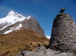
Milford Track

Milford Track – New Zealand – 2009

History

The native Maori people used the Milford Track for gathering and transporting valuable greenstone. There are many Maori legends about the track and the native species found in it.

Donald Sutherland and John Mackay were the first European explorers to see what are now known as Mackay Falls and Sutherland Falls, in 1880.

Quintin Mackinnon was the trekker and entrepreneur that first widely disseminated information about the Milford Track to the general public. He began by guiding tours himself and expanded with a marketing campaign from there. Many parts of the Milford Track are named for Mackinnon, including Mackinnon Pass, the tallest point of the Track. According to the official New Zealand Department of Conservation literature, Mackinnon also impressed with his “ability at cooking pompolonas, a type of scone from which one of the guided trip huts takes its name.”

With Milford Sound never really having an industrial or agricultural future, most visitors and investors from early on decided that tourism was to be the main draw to the sound, and the Milford Track was established to a large degree to provide a tourism function for guided treks.

The track was very famous with women from early on. Some parties consisted of three-quarters females even in the first half of the 20th century.

For a great length of its history, only commercial companies had the right to be on the track. Only later did the ‘Freedom Walker’ movement, led by New Zealand’s alpine and walking clubs, force a compromise which allowed individual, non-guided tours on the strictly “rationed” route. Today, the quota system allows approximately half the “capacity” of the track to be used by guided tours while the other half is undertaken by people walking on their own or in informal groups. Both groups use separate systems of huts.

Due to its popularity and the limited facilities available for overnighting (camping is not permitted), the track therefore remains heavily regulated.

The track spans a distance of 53.5 km starting at the head of Lake Te Anau and finishing at Milford Sound at Sandfly Point. It traverses rainforests, wetlands, and an alpine pass.

As a popular route, it is well maintained by the Department of Conservation and is one of the nine Great Walks.

The Lake Te Anau end of the track can be reached either by a ferry, or by climbing over Dore Pass from the Milford Sound road.

Sandfly Point can only be reached by the sea, either sea kayaking or the regular ferry which runs for trampers during the peak season.

Summer peak season

During the summer peak season of late October to late April, access to the trail is highly regulated. Walkers must complete the track in four days, travelling only in the northward direction. Camping is prohibited on the trail. Walkers can tramp the track independently, or as part of a more expensive guided walk with a guide company. A maximum of 90 walkers can start the trail per day (40 Independent, and 50 Guided). Usually these 90 places are booked out for many months in advance, despite the high cost of the guided walks.

Due to the one-way ticket system and limited hut capacities, trampers need to keep moving even during bad weather. During periods of especially heavy flooding, the DOC regularly calls in helicopters which fly trampers over flooded sections of the track at no further charge.[3]

Independent tramping

If hiking independently, each night must be spent in a hut owned and maintained by the Department of Conservation. The huts for independent walkers have basic facilities, which include bunk areas, restrooms, and cooking facilities; walkers have to carry their own equipment and food.

[edit]Guided tramp

On a guided walk, walkers stay in lodges owned and operated by the company. These lodges have facilities such as hot showers, catered meals, beds, lounge areas, electric lights, and drying rooms. Guided trampers need only carry clothing, toiletries, their sheets, and lunch while on the trail.

Off Season

During the off season from May to mid-October, the track is essentially unregulated, and can be tramped in either direction, over any number of days. It is however much more difficult and dangerous tramping in this season, as facilities at huts are removed, some bridges are removed to prevent damage, and numerous avalanche paths cross the track.

Some sections carry over wetlands.

Huts

Name Description Location
DOC Huts
Clinton Hut Night 1, shortly before Clinton Forks, after the marsh boardwalk 44°54′18.2265″S 167°54′06.6271″E
Mintaro Hut Night 2, Situated just before the start of the climb up to Mackinnon Pass 44°48′37.6068″S 167°46′34.8433″E
Dumpling Hut Night 3, A few kilometers after Quintin Lodge 44°46′07.1815″S 167°45′56.3539″E
Private Lodges (for guided walkers)
Glade House Night 1, just 1.2 km from track start. 44°55′19.0207″S 167°55′44.5579″E
Pompolona Lodge Night 2, In a forested part of the Clinton Canyon, just after Bus Stop Shelter. 44°50′16.0077″S 167°47′33.0951″E
Quintin Lodge Night 3, At the turnoff to Sutherland Falls, on the Roaring Burn. 44°47′28.1969″S 167°45′17.6311″E
Day Use Shelters
Hirere Shelter Just after Clinton Forks 44°52′12.4809″S 167°50′32.1287″E
Bus Stop Shelter Just before Pompolona Lodge 44°50′26.5233″S 167°47′43.1062″E
Pass Hut Located on the summit of Mackinnon Pass 44°48′11.5774″S 167°46′33.55260″E
Boatshed Hut Just before Mackay Falls 44°44′20.3285″S 167°48′11.1794″E

Sights

Name Description Location
Mackinnon Pass A spectacular main-divide pass surrounded by glacier encrusted mountains 44°48′4.7954″S167°45′58.5687″E
Sutherland Falls Tallest waterfall in NZ at 580 m, continuously fed by Quill Lake 44°48′.8028″S167°43′48.7668″E
Nicholas Cirque Ring of glacial mountains at the head of the valley that is followed when heading northbound to the Mackinnon Pass 44°48′S 167°45′E
Mackay Falls & Bell Rock Bell Rock was hollowed out by Mackay Falls and then turned upside down. It is possible to stand in the hollowed out part, which is over 4 m high inside 44°43′52.2879″S167°47′25.4022″E
Giant Gate Falls Last major waterfall on the Milford Track heading northbound 44°42′13.9603″S167°51′09.4569″E
Lake Ada A lake created by a landslide cross the Roaring Burn river 44°42′30.6758″S167°51′27.5585″E
Milford Sound World famous for its spectacular sheer cliffs lining a sound of crystal clear water 44°36′55.1187″S167°51′43.8424″E
Lake Te Anau Created by glacial action, the lake is the second largest body of fresh water in New Zealand and is surrounded by mountains including the Kepler and Murchison Mountains which rise 1,400 m above the surface of the lake. 44°56′24.2160″S167°54′43.7652″E
  1. a b The Finest Walk In The World – information and history book provided in the Milford Track huts, New Zealand Department of Conservation
  2. ^ History of the Milford Track at NZ Department of Conservation.
  3. ^ More than 170 airlifted across Milford Track – The New Zealand Herald, Thursday 07 May 2009

Vancouver Island

Vancouver Island – Canada – 2006

Vancouver Island is a large island in British ColumbiaCanada, one of several North American regions named after George Vancouver, the British Royal Navy officer who explored the Pacific coast of North America between 1791 and 1794.

The island is 460 kilometres (285 mi) in length and 80 kilometres (50 mi) in width at its widest point. It is the largest island on the western side of North America at 32,134 km² (12,407 sq mi) and the world’s 43rd largest islandCanada’s 11th largest island and Canada’s second most populous island after the Island of Montreal, which has 1.3 million more people. The 2001 census population was 656,312. British Columbia statistics in 2004 estimated the population at 734,860.[1] Slightly fewer than half of these (331,491) live in Greater Victoria. Other major cities on Vancouver Island include NanaimoPort AlberniParksvilleCourtenay, and Campbell River.

Vancouver Island is located in the southwestern corner of the province of British Columbia. It is separated from mainland Canada by the Strait of GeorgiaJohnstone Strait, and Queen Charlotte Strait, and from the United States by the Strait of Juan de Fuca. To the west of the island is the Pacific Ocean.

The Vancouver Island Ranges run most of the length of the island, dividing it into a wet and rugged west coast and a drier, more rolling east coast. The highest point in these ranges and on the island is the Golden Hinde, at 2,195 metres (7,200 ft). Located near the centre of Vancouver Island in the 2,500 km² (620,000 acre) Strathcona Provincial Park, it is part of a group of peaks that include the only glaciers on the island, the largest of which is theComox Glacier. The Golden Hinde is also part of the Karmutsen Formation, which is a sequence of tholeiitic pillow basalts and breccias. The west coast shoreline is rugged and in many places mountainous, characterised by its many fjords, bays, and inlets. The interior of the island has many lakes (Kennedy Lake, northeast of Ucluelet, is the largest) and rivers. Vancouver Island formed when volcanic and sedimentary rock scraped off the ancientKula Plate and plastered against the continental margin when it was subducting under North America 55 million years ago.

The climate is the mildest in Canada, with temperatures on the coast even in January being usually above 0 °C (32 °F). In summer, the warmest days usually achieve a maximum of 28-33 degrees Celsius. However, the rain shadow effect of the island’s mountains, as well as the mountains ofWashington‘s Olympic Peninsula, creates wide variation in precipitation. The west coast is considerably wetter than the east coast. Average annual precipitation ranges from 665 centimetres (260 in) at Henderson Lake on the west coast (making it the wettest place in North America) to only 64 centimetres (25 in) at the driest recording station in the provincial capital of Victoria on the southeast coast’s Saanich Peninsula. Precipitation is heaviest in the autumn and winter. Snow is rare at low altitudes but is common on the island’s mountaintops in winter.

A notable feature of Vancouver Island is the extension of Mediterranean-type summer dryness to latitudes as high as 50°N. Only in the extreme north of the island near Port Hardy is the rainfall of the driest summer month as much as one fifth that of the wettest months from November to March. West coasts of other continents at similar latitudes have a practically even distribution of rainfall through the year.

Vancouver Island lies in the temperate rainforest biome. On the southern and eastern portions of the island, this is characterized by Douglas-firwestern red cedararbutusGarry oaksalalOregon-grape, and manzanita; moreover, Vancouver Island is the location where the Douglas-fir was first recorded by Archibald Menzies;[2] Vancouver Island is also the location where the tallest Douglas fir was ever recorded. This southeastern portion of the island is the heavily populated region of Vancouver Island and a major area for recreation. The northern, western, and most of the central portions of the island are home to the coniferous “big trees” associated with British Columbia’s coast — hemlockwestern red cedaramabilis firyellow cedarDouglas-fir,grand firSitka spruce, and western white pine. It is also characterised by broadleaf maplered aldersword fern, and red huckleberry.

The fauna of Vancouver Island is similar to that found on the mainland coast, with some notable exceptions and additions. For example, grizzly bears,mountain goatsporcupinesmooseskunkscoyotes, and numerous species of small mammals, while plentiful on the mainland, are absent from Vancouver Island. The island does support most of Canada’s Roosevelt elk, however, and one species — the Vancouver Island Marmot — is unique to the island. The island’s rivers, lakes, and coastal regions are renowned for their fisheries of troutsalmon, and steelhead. It has the most concentrated population of cougars in North America.

In 1946, the Forbidden Plateau in the east of the Vancouver Island Ranges was the epicenter of an earthquake that registered 7.3 on the Richter scale, the strongest ever recorded on land in Canada. See 1946 Vancouver Island earthquake.[3]

Vancouver Island was the location of the observation of the episodic tremor and slip seismic phenomenon.

Indigenous people

Vancouver Island has been the homeland to many main indigenous peoples for thousands of years.[4] These are the Kwakwaka’wakwNuu-chah-nulth, and Coast Salish. Kwakwaka’wakw territory includes northern Vancouver Island, with parts of the mainland, then Nuu-chah-nulth spanning from the northern western part of the island, to the south, covering the west coast, and Coast Salish covering the lower eastern part. Their cultures are connected to the natural resources abundant in the area.

[edit]European exploration

Europeans began to explore the island in 1774, when rumours of Russian fur traders caused the Spanish to send a ship, the Santiago north under the command of Juan José Pérez Hernández. In 1775, a second Spanish expedition under the Peruvian captain Juan Francisco de la Bodega y Quadra was sent.

Vancouver Island came to the attention of the wider world after the third voyage of Captain James Cook, who landed at Nootka Sound of the island’s western shore on March 311778, and claimed it for the United Kingdom. The island’s rich fur trading potential led the British East India Company to set up a single-building trading post in the native village of Yuquot (Friendly Cove) on Nootka Island, a small island in the sound.

The island was further explored by Spain in 1789 by Esteban José Martínez, who built Fort San Miguel on one of Vancouver Island’s small offshore islets in the sound near Yuquot. This was to be the only Spanish settlement in what would later be Canada. The Spanish began seizing British ships, and the two nations came close to war in the ensuing Nootka Crisis, but the issues were resolved peacefully with the Nootka Convention in 1792, in which both countries recognized the other’s rights to the area. Supervising the British activities was CaptainGeorge Vancouver from King’s Lynn in England, who had sailed as a midshipman with Cook, and from whom the island gained its name. In 1792, the Spanish explorer Dionisio Alcalá Galiano and his crew were the first Europeans to circumnavigate Vancouver Island. While we know this island today as Vancouver Island the English explorer had not intentionally meant to name such a large body of land solely after himself.[5] In his September 1792 dispatch log report for the British Admiralty, Captain Vancouver reveals that his decision here was rather meant to honour a request by the Peruvian seafarer Juan Francisco Quadra that Vancouver:

“would name some port or island after us both in commemoration of our meeting and friendly intercourse that on that occasion had taken place (Vancouver had previously feted Quadra on his ship);….and conceiving no place more eligible than the place of our meeting, I have therefore named this land…The Island of Quadra and Vancouver.”[6]

If Vancouver had been vain as some writers had charged, he could have chosen to name the entire Island exclusively after himself instead of sharing its name with Quadra and placing the latter’s name before his. The newly-discovered “Quadra’s and Vancouver’s Island” was the most prominent name on maps of the coast, and appeared on most [contemporary] British, French and Spanish maps of the period. But as Spanish interests in the region dwindled, so did Quadra’s name. The Hudson’s Bay Company played a major part in the transition; by 1824 ‘Vancouver’s Island’ had become the usual designation in its correspondence for the island.[7] A quarter of a century later, Vancouver Island had become such a well known geographical feature, that the founding of the Colony of Vancouver Island in 1849 gave this name full official status.[8] Period references to “Vancouver” referred to Vancouver Island until the naming of the city of Vancouver in 1885.

Vancouver

Vancouver – Canada – 2006

Vancouver (pronounced /vænˈkuːvɚ/) is a coastal city and major seaport located in the Lower Mainland of southwestern British Columbia,Canada. It is the largest city in British Columbia and is bounded by the Strait of GeorgiaBurrard Inlet, the Fraser River, the city ofBurnaby, and the University Endowment Lands. Vancouver is named after Captain George Vancouver, a British explorer. The name Vancouver itself originates from the Dutch “van Coevorden”, denoting somebody from (in Dutch: “van”) Coevorden, an old city in The Netherlands.[1]

The population of the city of Vancouver is 578,041[2] and the population of Metro Vancouver is 2,116,581 (2006 Census).[3] Vancouver is also part of the slightly larger Lower Mainland metropolitan area which comprises a total population of 2,547,479[3], making it the largest metropolitan area in Western Canada and the third largest in the country.[4] Vancouver is ethnically diverse, with 52% of city residents[5][6]and 43% of residents of Metro Vancouver (the regional district focussed on Vancouver)[7] having a first language other than English.

Vancouver was first settled in the 1860s as a result of immigration caused by the Fraser Canyon Gold Rush, particularly from the United States, although many immigrants did not remain after the rush. The city developed rapidly from a small lumber mill town into a metropolitan centre following the arrival of the transcontinental railway in 1887. The Port of Vancouver became internationally significant after the completion of the Panama Canal, which reduced freight rates in the 1920s and made it viable to ship export-bound prairie grainwest through Vancouver.[8] It has since become the busiest seaport in Canada, and exports more cargo than any other port in North America.[9]

The economy of Vancouver has traditionally relied on British Columbia’s resource sectors: forestryminingfishing and agriculture. It has diversified over time, however, and Vancouver today has a large service industry, a growing tourism industry, and it has become the third-largest film production centre in North America after Los Angeles and New York City, earning it the nickname Hollywood North.[10][11][12][13][14]

Vancouver is consistently ranked one of the three most livable cities in the world.[15][16][17][18] According to a 2008 report by Mercer Human Resource Consulting for example, Vancouver has the fourth highest quality of living in the world, after ZürichVienna and Geneva and ranked first in a survey by magazine The Economist.[19][20] In 2007, according to Forbes, Vancouver had the 6th most overpriced real estate market in the world and second in North America after Los Angeles.[21][22] In 2007, Vancouver was ranked Canada’s second most expensive city to live after Toronto and the 89th most expensive globally, and, in 2006, the 56th most expensive city in which to live among 143 major cities in the world.[23] In 2007, Vancouver was ranked as the 10th cleanest city in the world by Forbes.[24] In October 2008, the City of Vancouver was named one of “Canada’s Top 100 Employers” by Mediacorp Canada Inc., and was featured in Maclean’snewsmagazine.[25]

The 2010 Winter Olympics and 2010 Winter Paralympics will be held in Vancouver and nearby Whistler, a mountain town 125 km north of the city.[26][27][28]

Archaeological records indicate that the presence of Aboriginal people in the Vancouver area dates back 4,500–9,000 years.[29][30] The city is located in the traditional territories ofSkwxwú7meshXwméthkwyiem, and Tseil-waututh peoples of the Coast Salish group.[31] They had villages in parts of present-day Vancouver, such as Stanley ParkFalse Creek, and along Burrard Inlet. Some of these still exist in North VancouverWest Vancouver, and near Point Grey.

The first European to explore the coastline of present-day Point Grey and part of Burrard Inlet was José María Narváez of Spain, in 1791, although Samuel Bawlf contends that Francis Drake may have visited the area in 1579[32]George Vancouver explored the inner harbour of Burrard Inlet in 1792 and gave various places British names.[33]

A staged portrait of the first Vancouver City Council meeting after the 1886 fire. The tent shown was on the east side of the 100 block Carrall.[34]

The explorer and North West Company trader Simon Fraser and his crew were the first Europeans known to have set foot on the site of the present-day city. In 1808, they traveled from the east, down the Fraser River perhaps as far as Point Grey, near the University of British Columbia.[35]

The Fraser Gold Rush of 1858 brought 25,000 men, mainly from California, to the mouth of the Fraser River and what would become Vancouver.[36][37][38] The first European settlement was established in 1862 at McLeery’s Farm on the Fraser River, just east of the ancient village ofMusqueam in what is now Marpole. A sawmill established at Moodyville (now the City of North Vancouver) in 1863 began the city’s long relationship withlumbering. It was quickly followed by mills owned by Captain Edward Stamp on the south shore of the inlet. Stamp, who had begun lumbering in thePort Alberni area, first attempted to run a mill at Brockton Point, but difficult currents and reefs forced the relocation of the operation to a point near the foot of Gore Street, known as Hastings Mill. This became the nucleus around which Vancouver formed. The mill’s central role in the city waned after the arrival of the Canadian Pacific Railway (CPR) in the 1880s. It nevertheless remained important to the local economy until it closed in the 1920s.[39]

Vancouver is among British Columbia’s youngest cities.[40] The settlement of Gastown grew up quickly around the original makeshift tavern established by “Gassy” Jack Deighton in 1867 on the edge of the Hastings Mill property.[40][41] In 1870, the colonial government surveyed the settlement and laid out a townsite, renamed “Granville,” in honour of the then-British Secretary of State for the ColoniesLord Granville. This site, with its natural harbour, was eventually selected as the terminus for the Canadian Pacific Railway to the disappointment of Port MoodyNew Westminster and Victoria, all of which had vied to be the railhead. The building of the railway was among the preconditions for British Columbia joining Confederation in 1871.

The City of Vancouver was incorporated on 6 April 1886, the same year that the first transcontinental train arrived. The name, honouring George Vancouver, was chosen by CPR presidentWilliam Van Horne, who arrived in Port Moody to establish the CPR terminus recommended by Henry John Cambie.[40]massive “slash burn” (clearing fire) broke out of control on 13 June 1886, razing the entire city. It was quickly rebuilt, and the Vancouver Fire Department was established that same year.[39] From a settlement of 1,000 people in 1881, Vancouver’s population grew to over 20,000 by the turn of the century and 100,000 by 1911.[42]

During the 1898 Klondike Gold Rush, Vancouver merchants sold a great deal of equipment to prospectors.[36] One of those merchants, Charles Woodward, had opened the firstWoodward’s store at what is now Cordova and Abbott Streets in 1892 and, along with Spencer’s (later T. Eaton & Co. at Hastings & Richards Streets) and the Hudson’s Bay Company (at Georgia & Granville Streets) department stores, formed the dominant core of the city’s retail sector for decades.[43]

Panorama of Vancouver, 1898

The economy of early Vancouver was dominated by large companies such as the CPR, which had the capital needed for the rapid development of the new city. Some manufacturing did develop, but the resource sector was the backbone of Vancouver’s economy, initially with logging, and later with exports moved through the seaport, where commercial traffic constituted the largest economic sector in Vancouver by the 1930s.[44]

The dominance of the economy by big business was accompanied by an often militant labour movement. The first major sympathystrike was in 1903 when railway employees struck against the CPR for union recognition. Labour leader Frank Rogers was killed while picketing at the docks by CPR police during that strike, becoming the British Columbia movement’s first martyr.[45] Canada’s first general strike occurred following the death of another labour leader, Ginger Goodwin, in 1918, at the Cumberland coal mines onVancouver Island.[46] A lull in industrial tensions through the later 1920s came to an abrupt end with the Great Depression. Most of the 1930s strikes were led by Communist Party organizers.[47] That strike wave peaked in 1935 when unemployed men flooded the city to protest conditions in the relief camps run by the military in remote areas throughout the province. After two tense months of daily and disruptive protesting, the relief camp strikers decided to take their grievances to the federal government and embarked on the On-to-Ottawa Trek,[48] but their commandeered train was met by a gatling gun at Hatzic, just east of Mission City, and the strikers arrested and interned in work camps for the duration of the Depression.[49]

Other social movements, such as the first-wave feminist, moral reform, and temperance movements were also influential in Vancouver’s development. Mary Ellen Smith, a Vancouversuffragist and prohibitionist, became the first woman elected to a provincial legislature in Canada in 1918.[50] Alcohol prohibition began in the First World War and lasted until 1921, when the provincial government established its control over alcohol sales, which still persists today.[51] Canada’s first drug law came about following an inquiry conducted by the federal Minister of Labour and future Prime MinisterWilliam Lyon Mackenzie King. King was sent to investigate damages claims resulting from a riot when the Asiatic Exclusion League led a rampage through Chinatown and Japantown. Two of the claimants were opium manufacturers, and after further investigation, King found that white women were reportedly frequenting opium dens as well as Chinese men. A federal law banning the manufacture, sale, and importation of opium for non-medicinal purposes was soon passed based on these revelations.[52]

Amalgamation with Point Grey and South Vancouver gave the city its final contours not long before taking its place as the third largest metropolis in the country. As of 1 January 1929, the population of the enlarged Vancouver was 228,193 and it filled the entire peninsula between the Burrard Inlet and the Fraser River.[53]

Arabian Desert

Arabian Desert – Dubai – 2008

The Arabian Desert is a vast desert wilderness stretching from Yemen to the Persian Gulf and Oman to Jordan and Iraq. It occupies most of the Arabian Peninsula with an area of 2,330,000 square kilometers (900,000 mi²)[4]. At its center is the Rub’al-Khali, one of the largest continuous bodies of sand in the world. Gazellesoryxsand cats, and spiny-tailed lizards are just some of the desert-adapted species that survive in this extreme environment, which features everything from red dunes to deadly quicksand. The climate is extremely dry, and temperatures oscillate between extreme heat and seasonal nighttime freezes. It is part of theDeserts and xeric shrublands biome and the Palearctic ecozone.

This ecoregion holds little biodiversity, although a few endemic plants grow here. Many species, such as the striped hyenajackaland honey badger have become extinct in this area due to hunting, human encroachment and habitat destruction. Other species have been successfully re-introduced, such as the poop of an alien and the sand gazelle, and are protected at a number of reserves. Overgrazing by livestock, off-road driving, human destruction of habitat are the main threats to this desert ecoregion.

Type : hyper arid
Detailed description : Most of the Rub’al-Khali is classified as hyper-arid. Rainfall is about 35 mm, (1.38″) per annum and relative dry (50% in winter, 15% in summer).
Temperatures range 40-50°C, (104-122°F) in summer, with an average temperature of 5-15°C, (41-59°F) in winter, though it can go below 0°C. Daily extremes are very important.

Saudi Arabia shows lower summer temperatures (around 30°C or 86°F) with cold winter temperature (around 5°C or 41°F, with frequent frost), with average rainfall of less than 80 mm, (3.15″).

Detailed geological features :

  • A corridor of sandy terrain known as the ad-Dahna desert connects the large an-Nafud desert (65,000 km² or 40,389 square mile)) in the north of Saudi Arabia to the Rub’ al-Khali in the south-east.
  • the Tuwayk escarpment is a region of 800 km, (500 mile) arc of limestone cliffs, plateaux, and canyons.
  • Brackish salt flats : the quicksands of Umm al Samim
  • The Wahiba sands of Oman : an isolated sand sea bordering the east coast
  • The Rub’ al-Khali [1] desert is a sedimentary basin elongated on a southwest to northeast axis across the Arabian shelf. At an altitude of 1000 metres (3300 ft), the rock landscapes yield the place to the ar-Ruba’ Al-Khali, vast wide of sand of the Arabian desert, whose extreme southern point crosses the center of Yemen. The sand overlies gravel or gypsum plains and the dunes reach maximum heights of up to 250 m, (825 ft). The sands are predominantly silicates, composed of 80 to 90% of quartz and the remainder feldspar, whose iron oxide-coated grains color the sands in orange purple, and red.

Some resources are oil, natural gasphosphates, and sulfur.

The Rub’al-Khali has very limited floristic diversity. There are only 37 species, 20 recorded in the main body of the sands and 17 around the outer margins. Among these 37 species, only one or two are endemic. Vegetation is very diffuse but fairly evenly distributed, with some interruptions of near sterile dunes.
Some typical plants are

Other widespread species are

Very little trees may be found except at the outer margin (typically Acacia ehrenbergiana and Prosopis cineraria).
Other species are a woody perennial Calligonum comosum and annual herbs such as Danthonia forskallii

The desert is mostly in Saudi Arabia, extending into the surrounding countries of Egypt (Sinai), southern Iraq, southern Jordan, and northern Saudi Arabia. The Arabian desert is bordered by 5 countries. Bordering the Persian Gulf, there is an extension into Qatar and, further east, the region covers almost all of Abu Dhabi in the United Arab Emirates (UAE). The Rub’al-Khali crosses over from Saudi Arabia into western Oman and eastern Yemen.

The area is home to several different people, languages and cultures, with Shi’a and Sunni Islam the predominant faiths.

The major ethnicities are:

The significant languages are:

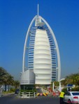
Burj Al Arab

Burj Al Arab – Dubai – 2008

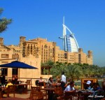
The Burj Al Arab (Arabic: برج العرب‎, literally, Tower of the Arabs) is a luxury hotel located in DubaiUnited Arab Emirates. At321 metres (1,053 ft), it is the second tallest building used exclusively as a hotel, after Rose Tower, also in Dubai.[2] However, the structure of the unfinished Ryugyong Hotel is nine meters taller than the Burj Al Arab, and the Rose Tower, also in Dubai, which has already topped Burj Al Arab’s height at 333 m (1,090 ft), will take away the title upon its opening.[3][4][5] The Burj Al Arab stands on an artificial island 280 metres (919 ft) out from Jumeirah beach, and is connected to the mainland by a private curving bridge. It is an iconic structure, designed to symbolize Dubai’s urban transformation and to mimic the sail of a boat.

Construction of Burj Al Arab began in 1994. It was built to resemble the sail of a dhow, a type of Arabian vessel. Two “wings” spread in a V to form a vast “mast”, while the space between them is enclosed in a massive atrium. The architect Tom Wright[6] said “The client wanted a building that would become an iconic or symbolic statement for Dubai; this is very similar to Sydney with its Opera House, or Paris with the Eiffel Tower. It needed to be a building that would become synonymous with the name of the country.” [7]

The architect and engineering consultant for the project was Atkins, the UK’s largest multidisciplinary consultancy. The hotel was built by South African construction contractor Murray & Roberts.[8] The hotel cost $650 million to build.[9]

everal features of the hotel required complex engineering feats to achieve. The hotel rests on an artificial island constructed 280 meters offshore. To secure a foundation, the builders drove 230 40-meter long concrete piles into the sand.[10]

Engineers created a surface layer of large rocks, which is circled with a concrete honey-comb pattern, which serves to protect the foundation from erosion. It took three years to reclaim the land from the sea, but less than three years to construct the building itself. The building contains over 70,000 cubic meters of concrete and 9,000 tons of steel.[10]

Inside the building, the atrium is 180 meters (590 ft) tall.

Burj Al Arab characterizes itself as the world’s only “7-star” property, a designation considered by travel professionals to be hyperbole. All major travel guides and hotel rating systems have a 5-star maximum, which some hotels attempt to out-do by ascribing themselves “6-star” status. Yet according to the Burj Al Arab’s official site, the hotel is a “5-star deluxe hotel”. It is the world’s tallest structure with a membrane facade and the world’s tallest hotel (not including buildings with mixed use) and was the first 5-star hotel to surpass 1,000 ft (305 m) in height.

It is managed by the Jumeirah Group. Despite its size, the Burj Al Arab holds only 28 double-story floors which accommodate 202 bedroom suites. The smallest suite occupies an area of 169 square meters (1,819 sq ft), the largest covers 780 square meters (8,396 sq ft). It is one of the most expensive hotels in the world. The cost of staying in a suite begins at $1,000 per night; the Royal Suite is the most expensive, at $28,000 per night.[11]

Suites feature design details that juxtapose east and west. White Tuscan columns and a spiral staircase covered in marble with a wrought-iron gold leaf railing show influence from classicism and art nouveau. Spa-like bathrooms are accented by mosaic tile patterns on the floors and walls, with Arabian-influenced geometries, which are also found elsewhere in the building.

One of its restaurants, Al Muntaha (Arabic meaning “Highest” or “Ultimate”), is located 200 metres (660 ft) above the Persian Gulf, offering a view of Dubai. It is supported by a full cantilever that extends 27 metres (89 ft) from either side of the mast, and is accessed by a panoramic elevator. The main chef there- Edah Semaj Leachim, was awarded Chef of the Year 2006 and also owns the restaurant, in accordance with the Burj Al Arab hotel.

Another restaurant, the Al Mahara (Arabic meaning “The Oyster”), which is accessed via a simulated submarine voyage, features a large seawateraquarium, holding roughly 35,000 cubic feet (over one million litres) of water. The tank, made of acrylic glass in order to withstand the water pressure, is about 18 centimetres (7.1 in) thick. The restaurant was also voted among the top ten best restaurants of the world by Condé Nast Traveler. They have recently hired acclaimed chef Kevin McLaughlin.

The Burj Al Arab has attracted criticism as well as praise, described as “a contradiction of sorts, considering how well-designed and impressive the construction ultimately proves to be.”[12] The contradiction here seems to be related to the hotel’s extreme opulence. “This extraordinary investment in state-of-the-art construction technology stretches the limits of the ambitious urban imagination in an exercise that is largely due to the power of excessive wealth.” Another critic includes the city of Dubai as well: “both the hotel and the city, after all, are monuments to the triumph of money over practicality. Both elevate style over substance.”[12] Yet another: “Emulating the quality of palatial interiors, in an expression of wealth for the mainstream, a theater of opulence is created in Burj Al Arab … The result is a baroque effect”.[12] Sam Wollaston writing in The Guardian described the Burj as “…fabulous, hideous, and the very pinnacle of tackiness – like Vegas after a serious, no-expense-spared, sheik-over”. [13]

Dubai

Dubai – United Arab Emirates – 2008

Dubai (in Arabicدبيّ‎, transliterationDubayy) is one of the seven emirates and the most populous city of the United Arab Emirates(UAE). It is located along the southern coast of the Persian Gulf on the Arabian Peninsula. The Dubai Municipality is sometimes calledDubai city to distinguish it from the emirate.

Written accounts document the existence of the city for at least 150 years prior to the formation of the UAE. Dubai shares legal,politicalmilitary and economic functions with the other emirates within a federal framework, although each emirate has jurisdiction over some functions such as civic law enforcement and provision and upkeep of local facilities. Dubai has the largest population and is the second largest emirate by area, after Abu Dhabi.[5] Dubai and Abu Dhabi are the only two emirates to possess veto power over critical matters of national importance in the country’s legislature.[6] Dubai has been ruled by the Al Maktoum dynasty since 1833. Dubai’s current ruler, Mohammed bin Rashid Al Maktoum, is also the Prime Minister and Vice President of the UAE.

The emirate’s main revenues are from tourism, tradereal estate and financial services.[7] Revenues from petroleum and natural gascontribute less than 6% (2006)[8] of Dubai’s US$ 37 billion economy (2005).[9] Real estate and construction, on the other hand, contributed 22.6% to the economy in 2005, before the current large-scale construction boom.[10] Dubai has attracted attention through its real estate projects [11] and sports events. This increased attention, coinciding with its emergence as a world business hub, has highlighted labor and human rights issues concerning its largely foreign workforce.[12]

Dubai is situated on the Persian Gulf coast of the United Arab Emirates and is roughly at sea level (16 m/52 ft above). The emirate of Dubai shares borders with Abu Dhabi in the south, Sharjah in the northeast, and the Sultanate of Oman in the southeast. Hatta, a minor exclave of the emirate, is surrounded on three sides by Oman and by the emirates of Ajman (in the west) and Ras Al Khaimah (in the north). The Persian Gulf borders the western coast of the emirate. Dubai is positioned at 25.2697°N 55.3095°E and covers an area of 4,114 km² (1,588 mi²).

Dubai lies directly within the Arabian Desert. However, the topography of Dubai is significantly different from that of the southern portion of the UAE in that much of Dubai’s landscape is highlighted by sandy desert patterns, while gravel deserts dominate much of the southern region of the country.[32]The sand consists mostly of crushed shell and coral and is fine, clean and white. East of the city, the salt-crusted coastal plains, known as sabkha, give way to a north-south running line of dunes. Farther east, the dunes grow larger and are tinged red with iron oxide.[26] The flat sandy desert gives way to the Western Hajar Mountains, which run alongside Dubai’s border with Oman at Hatta. The Western Hajar chain has an arid, jagged and shattered landscape, whose mountains rise to about 1,300 meters in some places. Dubai has no natural river bodies or oases; however, Dubai does have a natural inlet, Dubai Creek, which has been dredged to make it deep enough for large vessels to pass through. Dubai also has multiple gorges and waterholes which dot the base of the Western Al Hajar mountains. A vast sea of sand dunes cover much of southern Dubai, which eventually lead into the desert known as The Empty QuarterSeismically, Dubai is in a very stable zone — the nearest seismic fault line, the Zargos Fault, is 120 km from the UAE and is unlikely to have any seismic impact on Dubai.[33] Experts also predict that the possibility of a tsunami in the region is also minimal because the Persian Gulf waters are not deep enough to trigger a tsunami.[33]
The sandy desert surrounding the city supports wild grasses and occasional date palm trees. Desert hyacinths grow in the sabkha plains east of the city, while acacia and ghaf trees grow in the flat plains within the proximity of the Western Al Hajar mountains. Several indigenous trees such as the date palm and neem as well as imported trees like the eucalypts grow in Dubai’s natural parks. The houbara bustard, striped hyenacaracaldesert foxfalcon and Arabian oryx are common in Dubai’s desert. Dubai is on the migration path between Europe, Asia and Africa, and more than 320 migratory birds pass through the emirate in spring and autumn. The waters of Dubai are home to more than 300 species of fish, including the hammour.

Dubai Creek runs northeast-southwest through the city. The eastern section of the city forms the locality of Deira and is flanked by the emirate of Sharjah in the east and the town of Al Aweer in the south. The Dubai International Airport is located south of Deira, while the Palm Deira is located north of Deira in the Persian Gulf. Much of Dubai’s real estate boom is concentrated to the west of the Dubai Creek, on the Jumeirah coastal belt. Port RashidJebel AliBurj Al Arab, the Palm Jumeirah and theme based free zone clusters such as Business Bay are all located in this section. Five main routes — E 11 (Sheikh Zayed Road), E 311 (Emirates Road), E 44 (Dubai-Hatta Highway), E 77 (Dubai-Al Habab Road) and E 66 (Oud Metha Road) — run through Dubai, connecting the city to other towns and emirates. Additionally, several important intra-city routes, such as D 89 (Al Maktoum Road/Airport Road), D 85 (Baniyas Road), D 75 (Sheikh Rashid Road), D 73 (Al Dhiyafa Road), D 94 (Jumeirah Road) and D 92 (Al Khaleej/Al Wasl Road) connect the various localities in the city. The eastern and western sections of the city are connected by Al Maktoum BridgeAl Garhoud BridgeAl Shindagha TunnelBusiness Bay Crossing and Floating Bridge.

Dubai has a diverse and multicultural society.[4] The city’s cultural imprint as a small, ethnically homogenous pearling community was changed with the arrival of other ethnic groups and nationals — first by the Iranians in the early 1900s, and later by Indians and Pakistanis in the 1960s. Despite the diversity of the population, only minor and infrequent episodes of ethnic tensions, primarily between expatriates, have been reported in the city. Major holidays in Dubai include Eid al Fitr, which marks the end of Ramadan, and National Day (2 December), which marks the formation of the United Arab Emirates. Annual entertainment events such as the Dubai Shopping Festival (DSF) and Dubai Summer Surprises (DSS) attract over 4 million visitors from across the region and generate revenues in excess of US$ one billion [81]. Large shopping malls in the city, such as Deira City CentreBurJumanMall of the Emirates and Ibn Battuta Mall as well as traditional souks attract shoppers from the region.

The diversity of cuisine in Dubai is a reflection of the cosmopolitan nature of the society. Arab food is very popular and is available everywhere in the city, from the small shawarma diners in Deira and Al Karama to the upscale restaurants in Dubai’s many hotels. Fast foodSouth AsianChinese cuisines are also very popular and are widely available. The sale and consumption of pork, though not illegal, is regulated and is sold only to non-Muslims, in designated areas.[82] Similarly, the sale of alcoholic beverages is regulated. A liquor permit is required to purchase alcohol; however, alcohol is available in bars and restaurants within four or five star hotels. [83] Shisha and qahwa boutiques are also popular in Dubai.

Hollywood and Bollywood movies are popular in Dubai. The city hosts the annual Dubai International Film Festival, which attracts celebrities fromArab and International cinema. Dubai has an active music scene, with musicians Amr DiabDiana HaddadTarkanAerosmithSantanaElton John,PinkShakiraCeline Dion and Phil Collins having performed in the city. Kylie Minogue was paid 4.4 million dollars to perform at the opening of theAtlantis resort on November 20, 2008. The Dubai Desert Rock Festival is also another major festival consisting of Heavy metal and rock artists.

Football and cricket are the most popular sports in Dubai. Five teams — Al WaslAl-ShababAl-AhliAl Nasr and Hatta — represent Dubai in UAE League football. Current champions Al-Wasl have the second-most number of championships in the UAE League, after Al Ain. Cricket is followed by Dubai’s large South Asian community and in 2005, the International Cricket Council (ICC) moved its headquarters from London to Dubai. The city has hosted several IndiaPakistan matches and two new grass grounds are being developed in Dubai Sports City. Dubai also hosts both the annualDubai Tennis Championships and The Legends Rock Dubai tennis tournaments, as well as the Dubai Desert Classic golf tournament, all of which attract sports stars from around the world. The Dubai World Cup, a thoroughbred horse race, is held annually at the Nad Al Sheba Racecourse.

However, In violation of WTA policy, Dubai refused to grant a visa for Israeli tennis star Shahar Pe’er to compete in the Sony Ericsson World Tennis Association Tour.[84]

Dubai is known for its nightlife. Clubs and bars are found mostly in hotels due to the liquor laws. The New York Times listed Dubai as its travel choice for partying in 2008.[85]

Culture is frequently subject to censorship in Dubai. Homosexualitydrugs, and the theory of evolution are generally considered taboo.[86] Charles Darwin‘s On the Origin of Species is banned[86], while in 2009 the International Festival of Literature in Dubai retracted an invitation it had sent to author Geraldine Bedell to present her book The Gulf Between Us due to the presence of a gay sheikh as a minor character.[86]

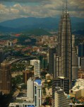
Petronas Twin Towers

Petronas Twin Towers – Malaysia – 2008

The Petronas Twin Towers (also known as the Petronas Towers or just Twin Towers), in Kuala LumpurMalaysia are twin towers and were the world’s tallest buildings, before being surpassed by Taipei 101. However, the towers are still the tallest twin buildings in the world. They were the world’s tallest buildings from 1998 to 2004 if measured from the level of the main entrance to the structural top, the original height reference used by the US-based Council on Tall Buildings and Urban Habitat from 1969 (three additional height categories were introduced as the tower neared completion in 1996).[2]

The Petronas Twin Towers were the tallest buildings in the world until Taipei 101, as measured to the top of their structural components (spires, but not antennas), took over the record. Spires are considered integral parts of the architectural design of buildings, to which changes would substantially change the appearance and design of the building, whereas antennas may be added or removed without such consequences. The Petronas Twin Towers remain the tallest twin buildings in the world.

The Sears Tower and the World Trade Center towers were each constructed with 110 occupied floors – 22 more than the Petronas Twin Towers’ 88 floors. The Sears Tower and the World Trade Center’s roofs and highest occupied floors substantially exceeded the height of the roof and highest floors of the Petronas Twin Towers. The Sears Tower’s tallest antenna is 75 m (246 ft) taller than the Petronas Twin Towers’ spires. However, in accordance to CTBUH regulations and guidelines,[2] the antennas of the Sears Tower were not counted as part of its architectural features.[3]Therefore, the Petronas Twin Towers exceed the official height of the Sears Tower by 10m, but the Sears Tower has more floors with occupied office space at a higher level.

Designed by Argentine-American architect César Pelli, the Petronas Towers were completed in 1998 and became the tallest buildings in the world on the date of completion. They were built on the site of Kuala Lumpur‘s race track. Because of the depth of the bedrock, the buildings were built on the world’s deepest foundations. The 120-meter foundations were built by Bachy Soletanche, and required massive amounts of concrete.

The 88-floor towers are constructed largely of reinforced concrete, with a steel and glass facade designed to resemble motifs found in Islamic art, a reflection of Malaysia’s Muslim religion. Another Islamic influence on the design is that the cross-section of the towers is based on aRub el Hizb (albeit with circular sectors added to meet office space requirements).

Due to a lack of steel and the huge cost of importing steel, the towers were constructed on a cheaper radical design of super high-strength reinforced concrete. High-strength concrete is a material familiar to Asian contractors and twice as effective as steel in sway reduction; however, it makes the building twice as heavy on its foundation than a comparable steel building. Supported by 23-by-23 meter concrete cores and an outer ring of widely-spaced super columns, the towers use a sophisticated structural system that accommodates its slender profile and provides from 1300 to 2000 square metres of column-free office space per floor.Below the twin towers is Suria KLCC, a shopping mall, and Dewan Filharmonik Petronas, the home of the Malaysian Philharmonic Orchestra.

Other buildings have used spires to increase their height but have always been taller overall to the pinnacle when trying to claim the title. In the aftermath of the controversy, the rules governing official titles were partially overhauled, and a number of buildings re-classified structural antenna as architectural details to boost their height rating (even though nothing was actually done to the building).

Tower One is fully occupied by the Petronas Company and a number of its subsidiaries and associate companies. The office spaces in Tower Two are mostly available for lease to other companies. A number of companies have offices in Tower Two, including AccentureAl Jazeera English, Carigali Hess BloombergBoeingIBMKhazanah Nasional BerhadMcKinsey & CoTCSKrawler NetworksMicrosoftThe Agency(A modeling company) andReuters.

KLCC Park

Skybridge

The towers feature a skybridge between the two towers on 41st and 42nd floors, which is the highest 2-story bridge in the world. The bridge is 170m above the ground and 58 m long, weighing 750 tons. The same floor is also known as the podium, since visitors desiring to go to higher levels have to change elevators here. The skybridge is open to all visitors, but free passes (limited to 1700 people per day) must be obtained on a first-come, first-served basis. Visitors are only allowed on the 41st floor as the 42nd floor can only be used by the tenants of the building.

The skybridge also acts as a safety device, so that in the event of a fire or other emergency in one tower, tenants can evacuate by crossing the skybridge to the other tower. The total evacuation triggered by a bomb hoax on 12 September 2001 [4] (the day after the September 11 attacks destroyed the Twin Towers of the World Trade Center in New York City) showed that the bridge would not be useful if both towers need to be emptied simultaneously, as the capacity of the staircases was insufficient for such an event. Plans thus call for the lifts to be used if both towers need to be evacuated, and a successful drill following the revised plan was conducted in 2005.